"It’s about 500 light-years away in the direction of one of the spiral arms of the Milky Way." Directions like those sound good in a science-fiction story, but they won’t help you find anything in the night sky. In this article, we will explain the coordinate systems that are actually used in astronomy.
The need for a coordinate system is obvious: it’s a way of pinpointing the exact locations of celestial objects in the sky.
The first thing to get used to, as a skywatcher, is that the Earth is the center of your universe, though not of the real one. That is, you are always standing on the Earth, and that’s what everything seems to revolve around.
Great Ball of Stars!
Specifically, it’s convenient to think of the sky as a gigantic celestial sphere, a globe surrounding the Earth. The sphere is assumed to be infinite in size; the planets and stars are so far away that their distances don’t matter. When you step outside and look up, the sky appears as a dome, a hemispherical bowl. It isn’t, of course, but the illusion works for our purposes.
As the Earth rotates, this bowl seems to twirl around. The Earth rotates from west to east, which causes the sky seemingly to rotate from east to west, once every 23 hours and 56 minutes (one sidereal day). The stars stay in fixed positions on the celestial sphere (because they’re so far away); the Sun, Moon, and planets gradually move around it in their orbits, so it takes four more minutes (making a total of 24 hours) for the Sun to get back to the same position.
Latitude and Longitude, Astronomy Style
On the celestial sphere, astronomers use lines similar to those of latitude and longitude on the Earth. The astronomical equivalent of latitude is declination, measured in degrees (°) of arc, positive for north and negative for south. Each degree is divided into sixty minutes (’), and each minute is divided into 60 seconds (’’). (Seconds are used only when great precision is needed.) "Declination" comes from a Latin word for "bending" or "angle."
The celestial equivalent of longitude is right ascension (a rather clunky term, for sure). It is measured in hours (0 to 24), minutes, and seconds, rather than degrees, for reasons we’ll get to presently. For example, the pole star, Polaris, is at right ascension 2 hours 32 minutes, declination +89° 16’. The Table below shows the right ascensions and declinations of some other bright stars.
Positions of some bright stars (Epoch 2000.0)
| Star | Right Ascension | Declination |
|---|---|---|
| Sirius (in Canis Major) | 6h 45m 09s | -16° 42’ 58’’ |
| Regulus (in Leo) | 10h 08m 22s | +11° 58’ 02’’ |
| Arcturus (in Boötes) | 14h 15m 40s | +19° 10’ 57’’ |
| Altair (in Aquila) | 19h 50m 47s | +8° 52’ 06’’ |
| Fomalhaut (in Piscis Austrinus) | 22h 57m 39s | -29° 37’ 20’’ |
The strange name "right ascension" has to do with the rising of a star as viewed from the Earth’s equator, where stars with low declinations rise (ascend) vertically (straight up).
The right ascensions and declinations of stars are essentially fixed, although they shift very slowly because of precession, a gradual change in the direction of the Earth’s axis. The reason most star charts say "Epoch 2000.0" is that they show star positions for the beginning of the year 2000. Earlier, we had Epoch 1950 and Epoch 1900 charts. The rate of precession is 1° every 72 years, but different parts of the sky are affected to different extents.
On the contrary, the Sun, Moon, planets, comets, and asteroids are not fixed relative to the stars. They move around. You have to look up their right ascension and declination for a particular date.
The declination of Polaris, +89° 16’, is almost 90° north, which means Polaris is less than a degree away from the north celestial pole. That’s the point around which the stars appear to twirl (for Northern Hemisphere viewers). You can line up the polar axis of an equatorial mount by sighting on Polaris. If you live south of the equator, you can’t see the north celestial pole; instead, you see the south celestial pole, which is not marked by a bright star (although Sigma Octantis is close). An old astronomers’ joke is to report the discovery of some interesting object "about ten degrees south of Sigma Octantis" — there’s no such place, because declinations range only from +90° to -90°.
The point directly over your head, the zenith, has a declination the same as your latitude on Earth. The point directly south of you on the horizon has negative declination of 90° minus your latitude; for example, declination -50° if your latitude is 40 north. That’s why objects such as the Magellanic Clouds, at declination -65°, are never visible from the continental United States.
We mentioned already that right ascension is measured in hours (0 to 24) rather than degrees (0° to 360°). The two are interconvertible, of course; one hour equals 15 degrees of arc. If you want to give right ascension in degrees, you can; celestial navigators do, and they call it sidereal hour angle (SHA).
The reason right ascension is measured in hours is of course that the celestial sphere seems to rotate as the Earth turns. Its rotation period is called one sidereal day, or 24 hours of sidereal time, which runs slightly faster than mean solar time. If a particular star is directly above you, it will be directly above you again 24 sidereal hours later, or 23 hours and 56 minutes later by the ordinary clock. The sidereal time at any moment is the right ascension of the point directly overhead, as well as points directly north and south of it (along a line called the meridian).
At the same mean solar time — midnight, for instance, or 10 p.m. — the sidereal time will be 4 minutes later each successive day. That’s because the Earth orbits the Sun. The celestial sphere seems to "slip" relative to the Sun (actually, the Sun is moving on the celestial sphere), and that’s why we see different constellations at different seasons.
Most objects rise in the east and set in the west. Along the way, they follow lines of declination, which are circles centered on the north celestial pole.
Some objects near the celestial pole are always above the horizon; they just whirl around and around without setting. They’re said to be circumpolar. Above the Arctic Circle, the circumpolar region is so large that the Sun gets into it and doesn’t set, resulting in the Midnight Sun.
What Does the Coordinate System Mean For Amateur Astronomers?
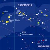
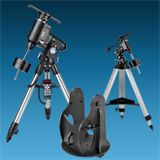
An object’s coordinates tell you where it is in the sky. If you have a telescope on an equatorial mount, you can locate celestial objects to view by "dialing in" their right ascension and declination coordinates using the mount’s setting circles. (We won’t go into how to do it here.) The setting circles on most equatorial mounts, and the mounts themselves, are not accurate enough to land you right on an object consistently, but they’ll get you close; then you merely have to sweep the telescope a bit using the slow-motion controls until you spot the object.
Conversely, you can use the setting circles to identify objects you happen upon in the sky. By noting the right ascension and declination values of an object your scope is pointed at, you can then look up the values in a star atlas or catalog to find out what it is.
Other coordinates are useful for other purposes. The most obvious are altitude (distance above the horizon, in degrees) and azimuth (compass direction; north = 0°, east = 90°, south = 180°, west = 270°). Computer programs can convert right ascension and declination into altitude and azimuth for a particular place and time.
Also important are ecliptic coordinates. The ecliptic is the line in the sky that corresponds to the Earth’s orbit around the Sun. The planets are always near the ecliptic, in a narrow band called the zodiac. Planetary orbits are always computed relative to the ecliptic, and ecliptic coordinates take the ecliptic as their "equator." Ecliptic latitude is the distance of an object from the ecliptic, and ecliptic longitude is measured along the ecliptic from the place where it passes through declination 0°.
There’s yet another set of coordinates that uses the center line of our galaxy as the equator. Galactic longitude is reckoned in degrees from the galactic center in Sagittarius; galactic latitude is the distance north or south of this center line. These coordinates are used in the study of the structure of our galaxy, but not for finding objects in the sky.


